If you could fast-forward Earth by a few million years, its surface would appear to move in slow motion.
Continents would drift apart and collide. Mountain ranges would rise, and ocean basins would open and close. At human timescales, though, most of this motion is difficult to notice. Tectonic plates commonly move only a few centimeters per year, roughly comparable to the rate at which fingernails grow, although relative motion varies among plate boundaries (Gordon & Stein, 1992). Over geological time, these motions shape ocean basins, mountain belts, volcanic regions, and earthquake-producing fault systems.
Three Types of Plate Boundaries
Plate boundaries are commonly grouped into three main types, although many real boundaries combine more than one style of motion.
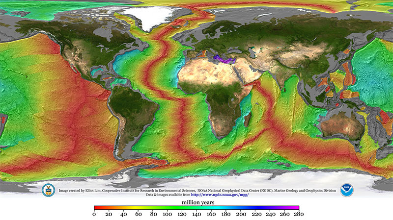
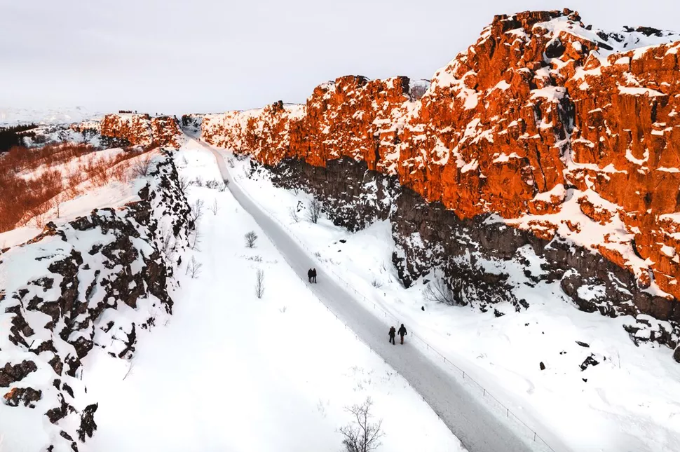
Divergent boundaries: plates pulling apart. At mid-ocean ridges, plates separate and new oceanic lithosphere is produced as seafloor spreading continues. The Mid-Atlantic Ridge is a major example. Iceland lies where this ridge crosses a region of unusually strong mantle upwelling, and the North American–Eurasian plate boundary passes across the island as a series of volcanic and seismic rift zones. Geodetic measurements indicate spreading of about 18 to 19 millimeters per year across Iceland. The motion is accommodated by a single rift zone in northern Iceland, overlapping rifts in southern Iceland, and a highly oblique rift across the Reykjanes Peninsula (Sigmundsson et al., 2020).
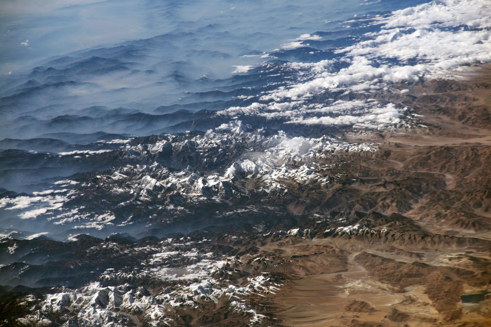
Convergent boundaries: plates moving toward each other. The outcome depends on the lithosphere involved. Where oceanic lithosphere converges with a continent, it may descend beneath the continental margin in a subduction zone. The Andes developed along the convergent margin between the Nazca and South American plates. Near the central Andes, Kendrick et al. (2003) reported present-day Nazca–South America convergence estimates of approximately 6.3 centimeters per year in their preferred geodetic solution, while noting that estimates vary with location and model. Continental collision is expressed differently. India converges with Asia at about 5.8 centimeters per year, and approximately 1.75 centimeters per year is accommodated as contraction across the Nepal Himalaya. This contraction contributes to continued shortening and uplift in the Himalayan region (Bilham et al., 1997).
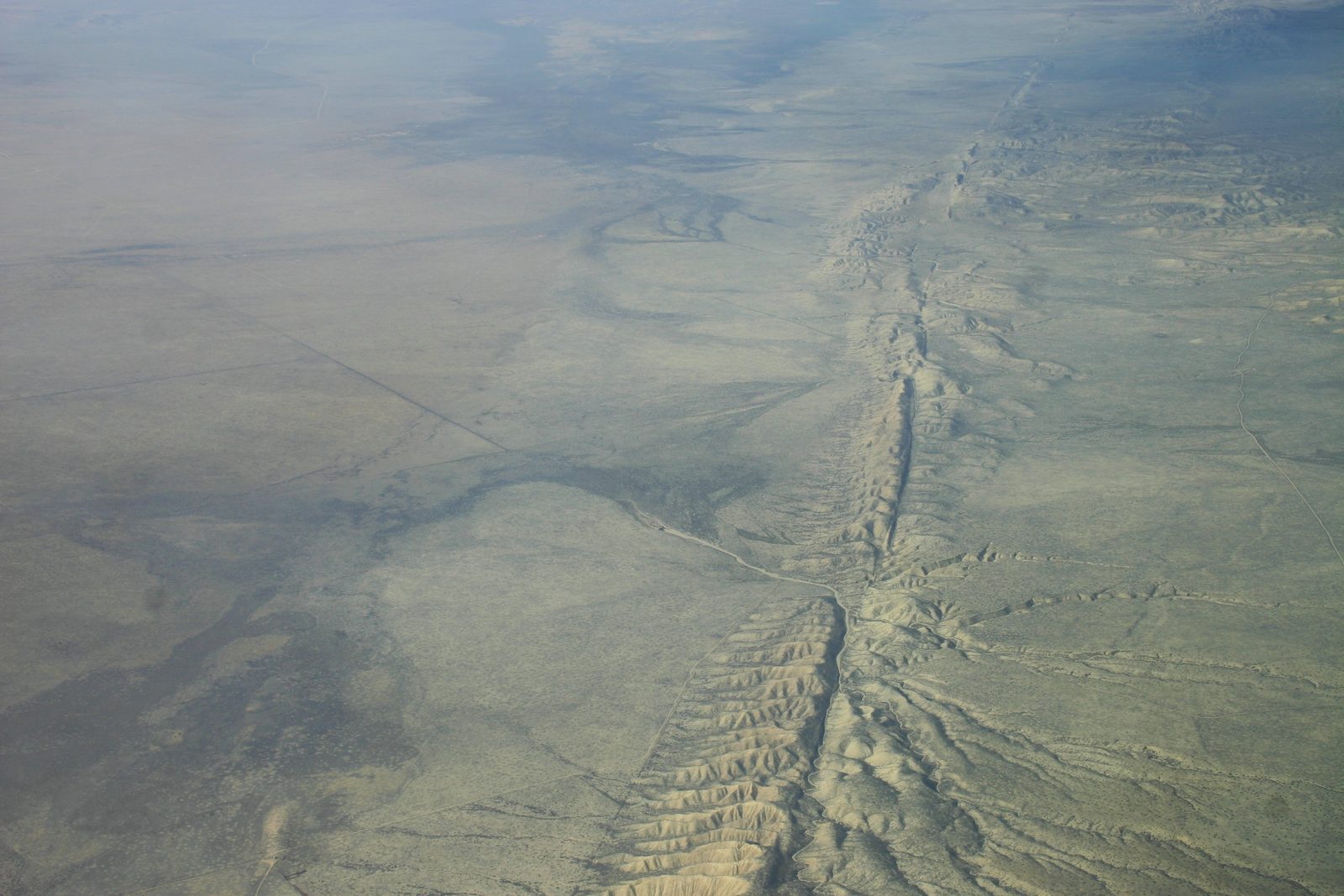
Transform boundaries: plates sliding past each other. At these boundaries, motion is mainly horizontal. Where sections of a fault remain locked, elastic strain may accumulate during the interval between earthquakes. Along California's San Andreas Fault, Meade and Hager (2005) estimated a right-lateral slip rate of 35.9 ± 0.5 millimeters per year for the Carrizo Plain segment. This corresponds to roughly 70% of the approximately 50 millimeters per year of total relative Pacific–North America plate motion at the latitude of the Carrizo Plain (Meade & Hager, 2005; DeMets et al., 2010). Türkiye's North Anatolian Fault is another major right-lateral strike-slip system. GPS velocities relative to Eurasia increase from about 20.6 millimeters per year in eastern and central Türkiye to about 24.6 millimeters per year in western Türkiye (Reilinger et al., 2006). They argued that a simple model in which Arabia pushes Anatolia westward is not sufficient to explain the present-day motion; instead, they hypothesized that rollback of subducting African lithosphere beneath the Hellenic and Cyprus trenches plays an important role. The authors also showed that pre-1999 GPS measurements across the İzmit segment were consistent with interseismic strain accumulation before the 1999 earthquake (Reilinger et al., 2006).
What Drives All This?
Plate tectonics is best understood as the surface expression of mantle convection rather than as rigid plates being carried by separate, simple convection wheels. In this view, the lithosphere forms the cold upper boundary layer of the convecting mantle, and subducting slabs are part of the same circulation system (Bercovici, 2003). Forsyth and Uyeda (1975) found that, for oceanic plates attached to substantial downgoing slabs, forces acting on the slabs exert a dominant control on plate velocity. This result should not be taken to mean that slab pull controls every plate in the same way. Earth is approximately 4.54 billion years old (Dalrymple, 2001), and the long-term loss of internal heat helps maintain the thermal contrasts that allow mantle convection to continue (Bercovici, 2003).
Up Next
Understanding how plates move is one thing. Understanding what happens when that motion suddenly releases is another. Next, we'll look at fault types and why some faults rupture catastrophically while others creep quietly, using real examples including the North Anatolian Fault and the San Andreas.
References
- Bercovici, D. (2003). The generation of plate tectonics from mantle convection. Earth and Planetary Science Letters, 205, 107–121.
- Bilham, R., Larson, K., Freymueller, J., & Project IDYLHIM members. (1997). GPS measurements of present-day convergence across the Nepal Himalaya. Nature, 386, 61–64.
- Dalrymple, G. B. (2001). The age of the Earth in the twentieth century: a problem (mostly) solved. Geological Society, London, Special Publications, 190, 205–221.
- DeMets, C., Gordon, R. G., & Argus, D. F. (2010). Geologically current plate motions. Geophysical Journal International, 181, 1–80.
- Forsyth, D., & Uyeda, S. (1975). On the relative importance of the driving forces of plate motion. Geophysical Journal of the Royal Astronomical Society, 43, 163–200.
- Gordon, R. G., & Stein, S. (1992). Global tectonics and space geodesy. Science, 256, 333–342.
- Kendrick, E., Bevis, M., Smalley, R., Brooks, B., Barriga Vargas, R., Lauría, E., & Souto Fortes, L. P. (2003). The Nazca–South America Euler vector and its rate of change. Journal of South American Earth Sciences, 16, 125–131.
- Meade, B. J., & Hager, B. H. (2005). Block models of crustal motion in southern California constrained by GPS measurements. Journal of Geophysical Research: Solid Earth, 110, B03403.
- Reilinger, R., et al. (2006). GPS constraints on continental deformation in the Africa–Arabia–Eurasia continental collision zone and implications for the dynamics of plate interactions. Journal of Geophysical Research: Solid Earth, 111, B05411.
- Sigmundsson, F., Einarsson, P., Hjartardóttir, Á. R., Drouin, V., Jónsdóttir, K., Árnadóttir, T., Geirsson, H., Hreinsdóttir, S., Li, S., & Ófeigsson, B. G. (2020). Geodynamics of Iceland and the signatures of plate spreading. Journal of Volcanology and Geothermal Research, 391, 106436.